

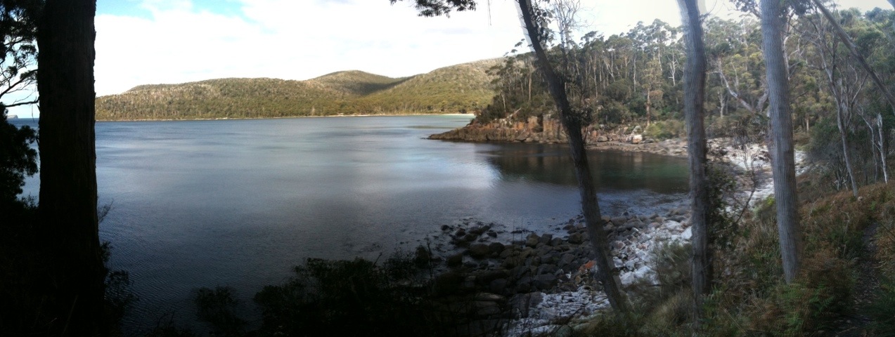
Canoe Bay is up in the north-west corner of Fortescue Bay, and it’s a beautiful part of the world.
The anchorage is in 3 to 3.5 meters of water behind the wreck. The approach is deep water, past a few kelp forests and then it starts to shallow. The shallowing comes up to about 4m before it deepens again on the way in. The area behind the wreck is bigger than it looks from the approach, and there a good depth of water right up to the shore. If swing room is a concern, you can always drop an anchor and run a line to the exposed bollard on the wreck.
We had west north westerly winds while we were there, and the weather report said they blew 20 to 25 knots elsewhere, but we never saw more than a few 10 knot gusts.
On the southern side by the point near the wreck, there is a track that extends down to the camping area in the southern section of the bay, and continues north along the coast as far as Pirates Bay. The track offers some fantastic views of the sea coast…
After we dropped anchor and tidied the boat up a bit from our rounding of Cape Pillar, we launched the dinghy and lacking a nice shore to pull her up on, med-moored her by a rocky shore using the dinghy’s anchor to hold her off.
While waiting for us grown up’s to get everything sorted, the kids ran amok. The sea anemone that our youngest found had dried and started to smell. The eldest thought it would be fun to smash it into tiny bits, with his fist. Unsurprisingly, he got bits of it in his hand and was bleeding. Sea anemone thorns are a nasty source of infection, and we took the opportunity to impress the importance of safety especially in remote places on the boys while I cleaned his hand first with disinfectant, then applied an antibiotic, then a bandage. I think he got it….
The walk south to the white beach in the southern end of the bay takes about an hour, and while the track goes up hill and down dale (and is quite muddy in spots) along the rugged coastline, it’s a pretty easy walk.
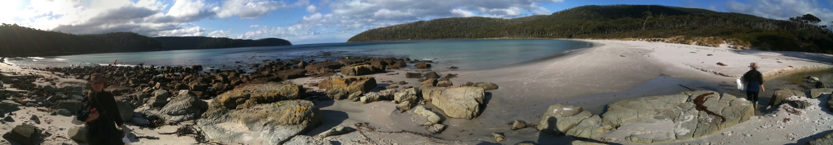
The boys enjoyed the beach and ran around, playing chicken with waves breaking ashore. Of course, we took a spare set of clothes for them!
We found some rubbish washed ashore, so we went looking for a rubbish bin. We found one near the Park Rangers office. After completing the now obligatory facebook update, we headed back toward the boat. We must have looked a sight; walking in sea-boots and foul weather jackets, in the wrong direction with no camping gear or food…. We found the dinghy where we left her and sat down with the CYCT Tasmanian Anchorage guide to work out when we had to leave in the morning to make the tide crossing the Marion Narrows.
High tide in this area is about the same as high tide in Hobart (it’s 16 minutes earlier as of September 2011). High tide on the next day was 9:44am, and given the distance, it would take us 4 hours to get there. That meant a 5am sail, or a 4:30am start. Ug.